Autonomous Shuttle Bus
HD Mapping, Map-Based Prediction, and Local Planning
I worked on HD map construction, map-based prediction, and local planning for a UNIST autonomous shuttle bus project. The campus demonstration connected a mapped driving route with surrounding-object perception and vehicle control, showing how the shuttle responded to vehicles and pedestrians along its path.
The driving scenarios included stopping for a vehicle ahead, following a moving vehicle while maintaining separation, and stopping after detecting a pedestrian. Target speeds were configured by route section, connecting route context to the shuttle’s driving behavior.
Demonstration
System Overview
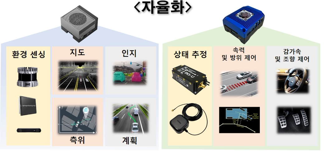
The shuttle platform brought together environmental sensing, mapping, localization, perception, planning, and vehicle control. The system overview also connects state estimation with speed, heading, steering, and acceleration/braking control.
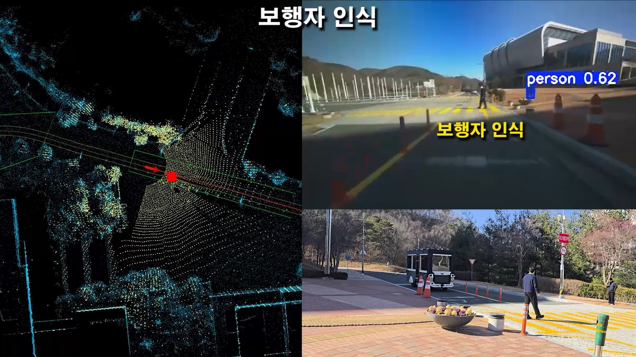
During the demonstration, the monitoring views combined a point-cloud map, the shuttle’s route and position, camera-based object detections, and external views of the vehicle. These views made it possible to inspect perception and the shuttle’s response within the same driving scene.
HD Mapping and Map-Based Prediction
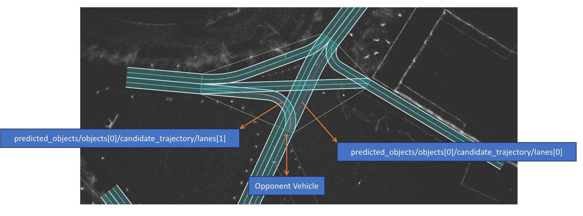
My work included building the HD map used as a reference for campus driving. The mapped environment provided spatial context for localization and route planning, while the point-cloud view supported checking the shuttle’s progress along the driving corridor.
I also worked on map-based prediction, using map context to inform surrounding-motion prediction for local planning. This connected the known road layout to decisions about how the shuttle should proceed around nearby road users.
Local Planning and Vehicle Interaction
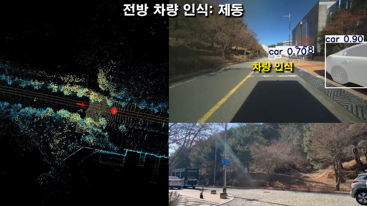
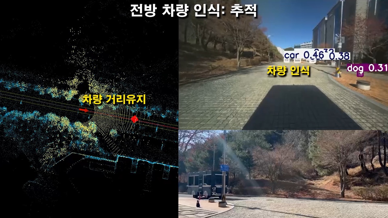
The local planning work connected the reference route, surrounding-object information, and the shuttle’s immediate driving response. Route-section speed targets provided the driving context, while the vehicle-ahead scenarios demonstrated braking and following behavior.
In the stopping scenario, the front camera identifies a vehicle on the route and the external view shows the shuttle’s response. In the following scenario, the visualization shows the detected lead vehicle together with the mapped route as the shuttle continues while maintaining separation.
Planning Videos
Pedestrian Response
The pedestrian scenario shows a person detected near a campus crossing and the shuttle stopping in response. Camera detections, the map-based monitoring view, and an external camera document the same interaction from complementary perspectives.
Together, these scenarios demonstrate the connection between the mapped route, object perception, local planning, and the vehicle’s physical response in a campus setting.
Contribution
I worked on HD map construction, map-based prediction, and local planning, connecting the mapped campus environment and surrounding-motion prediction to the shuttle’s route-based driving behavior.